You may already know that on the village web site we have an aerial photo of Milton from late in World War II or shortly afterwards. It’s a fascinating photo as it lets you see how much Milton has changed since the war (and also what happening around Milton during the war).
For those of you with Google Earth on your PC we now have that photo overlaid onto the surface. Here’s a preview:
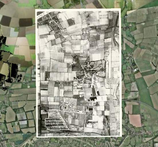
By toggling the image on and off or increasing or decreasing its transparency or turning on the “roads” layer it’s easy to precisely locate things in the photo. So if you do have Google Earth then click here for the KMZ file you’ll need.

